West Bay...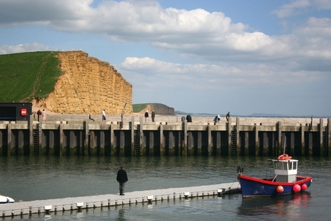
West Bay is one of Dorset’s most picturesque harbours and the most Westerly point of the Chesil Beach. It is also known to millions of TV viewers both as “Broadchurch” and “Bridehaven”, having featured in fictional dramas as both.
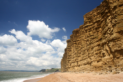
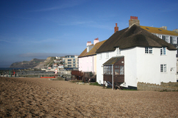
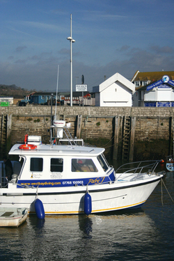
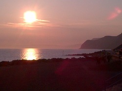
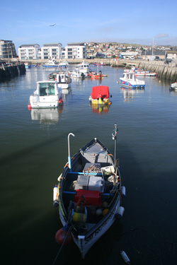
The harbour is home to a mix of commercial fishing boats, charter craft for diving and fishing and private leisure craft. The harbour itself is small, compact and pretty -as harbours go. It also marks the mouth of the River Brit which empties into the harbour after flowing through the nearby town of Bridport, where the River Asker also joins the Brit. Unlike much bigger Dorset harbours like Poole, Weymouth and Portland, West Bay lacks the advantage of being protected by the natural topography of the coast and opens directly into the wide expanse of Lyme Bay. Until recently this meant that skippers needed to navigate a narrow channel between two solid piers to make it in to, or out from, the open sea. It was a great thing to watch and presumably required significant skill to judge the right time to enter the harbour mouth and surf in on the waves. Since 2005, all that has changed with the completion of a new, multimillion-pound outer harbour, breakwater and slipway. This has received mixed reviews from boats owners, some of whom are reported to have found the new slipway tricky to handle. For those without boats the development’s great news. It means there’s a new promenade and viewing point across the harbour-mouth to East Cliff and the Chesil - which is a spectacular view, especially at sunset when the strata of the rocks are given extra definition. The development also means that there is a new beach to the West of the harbour-mouth. It’s not big and can be rough at times. But that is also true of the Chesil to the East of the harbour. At this end of the Chesil pebbles are at their smallest, in marked contrast to those at the Ferry Bridge and Portland end of the beach. West Bay itself is a wonderful place to visit at any time of the year, whether you want to walk around the harbour-side, along the beach or explore the South West Coast Path along the cliff-tops to the East or West. There are also riverside walks back into Bridport. In 2013 West Bay and Bridport were the focal point of ITV’s major drama “Broadchurch” featuring David Tenant, among many others. The series drew much attention to the area’s stunning coastal scenery, especially East Cliff. But this was not the first fictional drama to call West Bay and Bridport home or to use the Jurassic Coast for a backdrop. In the late nineties, West Bay featured in the TV series “Harbour Lights” and will be familiar to millions as the fictional town of Bridehaven. But make sure you don’t confuse these fictional towns with reality! In real life, the town is a mix of traditional fishing port and seaside tourism. There is also ongoing residential and holiday development in the harbour area, some of which seems to be targeted at the luxury end of the market. There’s fast food aplenty around the harbour-side with a multitude of chalets serving fish and chips and almost everything else. But there are also pubs, cafés and restaurants. The town also has one of the areas best-known and most popular fishmongers shops “Samways”, which is well-worth a visit if you can’t catch your own! |
West Bay is one of Dorset’s most picturesque harbours and the most Westerly point of the Chesil Beach. It is also known to millions of TV viewers both as “Broadchurch” and “Bridehaven”, having featured in fictional dramas as both .."
|
| www.dorsetcamper.com | West Bay |
www.DorsetCamper.comAnother web site from 2nd Pillar Projects
© 2016 All images and text © 2nd Pillar Projects unless otherwise stated 2nd Pillar Projects © COPYRIGHT 2016.
ALL RIGHTS RESERVED. |